Team Insight

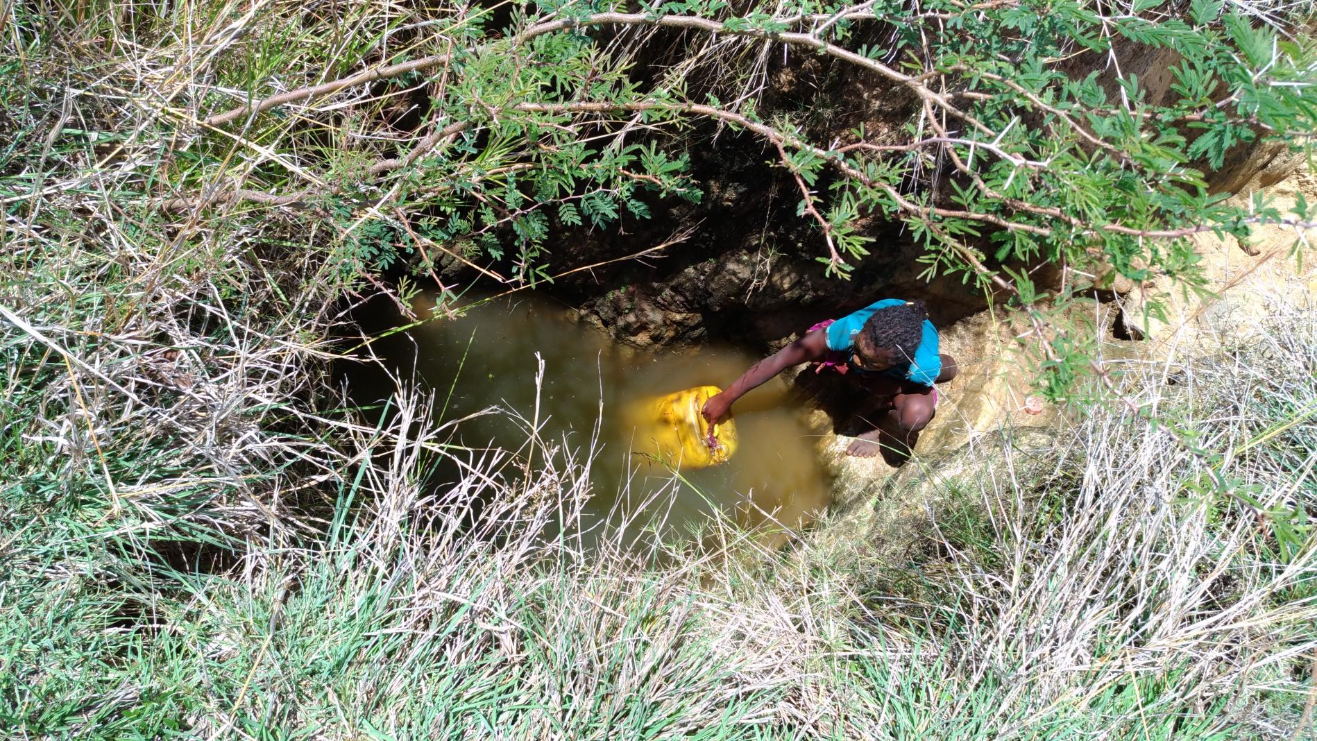
Improving Access to Safe Water in Southern Madagascar

Sep 17 , 2019
Girl fetching unsafe water
On this page

The new satellite imagery powered geophysical survey method was piloted with seed funding from the  UNICEF Innovation Fund. 


The southern regions of Madagascar have the country’s lowest water supply coverage and is highly vulnerable to drought. Access to potable drinking water us a major challenge for the local population. Chronic droughts lead to annual emergency appeals to save the lives of acute malnourished children.


Yet the root cause of this situation is the availability and access to safe water. Families often resort to negative coping strategies to the detriment of their children - such as having to discontinue their children’s education to be able to buy water at exorbitant prices (the price for a 20 liters jerry can of water increases from 200 Ariary to 2500 Ariary during peak times1).


In rural areas, only 36% of households utilize improved water facilities, like using borehole drilling (a deep, narrow hole made in the ground, especially to locate water); however, this method has a very low success rate due to the scarcity of groundwater and the high level of salinity.

Deep drilling

A NEW APPROACH TO LOCATING SAFE WATER 


UNICEF Madagascar explored the use of new scientific solutions to locate deep primary water resources formed by the accumulation of water vapor in the Earth’s lower mantle. This has never been explored before in UNICEF WASH programmes, as deposits are at a considerable depth and are inaccessible by traditional water exploration methods. Their approach involved using high precision geophysics (commonly used in the oil/mining industry), combined with satellite imagery to investigate these deep ground fractures potentially filled with primary water.


TESTING ON THE GROUND 


UNICEF implemented this innovative pilot project from October 2017 to December 2018. The geophysics study was conducted in two phases, fracture trace analysis and field survey, in the Androy region. Results revealed many fractures with a potential of water accumulation. From this, two pilot sites were identified for the drilling of deep boreholes.


The first UNICEF-supported deep drilling in a bedrock was conducted in the district of Tsihombe in May 2018. This deep borehole provided water at a depth of 85 meters with a yield of 4 m3/h; however, the physicochemical analysis showed quality issues — a high level of salinity, with high concentrations of chloride, magnesium, and sodium exceeding the national standard, including occasional smell and taste of sulfur. The second deep borehole drilled in the district of Ambovombe reached the bedrock at a depth of 105 m (the target was around 100 m). Unfortunately, it was dry; no water was found at this depth. As a result, both deep boreholes of this pilot were declared negative (non-productive).

Dry river in Madagascar

KEY OUTCOMES AND NEXT STEPS


Although no water was retrieved from the two pilots, this new approach confirmed the main constraints encountered in the south of Madagascar in terms of water scarcity and high salinity.


In addition, the methodological approach used in this study has proven the feasibility and applicability to explore deep groundwater in fractured bedrocks of southern Madagascar.  


These two pilot sites have identified that the geophysical survey needs to be combined with a detailed hydrogeological study and drilling logs. This refined integrated approach will increase the likelihood of finding quality water and the right depth before investing in drilling deep boreholes.


Making these adjustments will help in the pursuit to improve equitable access to safe water to families and children living in drought-affected areas of southern Madagascar.


This article originally appeared on UNICEF Office of Innovation website. 

Share this story
© UNICEF/UN0610362/Le Vu;
Team Insight
Oct 28 , 2022
BLockchain call 1
Team Insight
Jan 24 , 2022