Portfolio News

Geospoc Geospatial Graduates From Seed Stage Funding

Geospoc GeoSpatial Data Science+AI India
Oct 26 , 2021
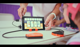
Teacher Ansharam Brahmane conducts Mohalla Class with Room to Read worksheets and library books in Gumdiya Bujurg, Block Niwali, Barwani, Madhya Pradesh with 5 students
On this page

Data Science+AI

Geospoc GeoSpatial

India
Amount invested $100,000 USD Funding Status graduated early period Founded in 2014 by Dhruva Rajan
Female Founded
Acquired
Generating Revenue

The UNICEF Venture Fund is proud to see a portfolio member Geospoc Geospatial graduate. They’ve come a long way – from numerous product iterations to deep diving into understanding their ecosystem better and strengthening their business model. During the investment, Geospoc was acquired by Ola to develop technologies that will make mobility universally accessible, sustainable, personalized, and convenient, across shared and personal vehicles.
The ability to collect accurate data and derive deep insights and turn those insights into making a difference is still a challenge in developing nations. To accurately depict a country's development status, it is essential to have some indicators. These could be based on a country's health and education facilities.

 Geo Qi Mapper Dashboard

The Solution

Geospoc aims to create a comprehensive database, analysis program and information visualization platform to help decision - makers in local governments/NGO's/CSR to make more informed decisions at the early stages of the planning process by taking all reliable and relevant data into account.
To respond to these data needs, our team developed Geo-Qi: Mapper that converts data into information that is very easy to understand. Built using Open Source technology, Geo-Qi: Mapper identifies features remotely, such as schools and urban hospitals, using machine learning.

User Testing

We arranged multiple demos and calls with stakeholders for the Geo-Qi: Mapper dashboard. Through these interviews we learned that if we could add additional information on our platform, such as network connectivity data, this would help our users understand where schools are and how well they are connected. The effects of COVID-19 forced multiple sectors to move online. The urban educational sector transitioned to online platforms more smoothly as compared to others; the challenge remains for rural areas, which often struggle with basic education infrastructure to access additional facilities like internet, or phones with 3G enabled. This feedback was considered, and network connectivity data was procured from Government sources and made available on the dashboard.

Open Source

Being Open Source has allowed multiple people to contribute to our projects. The Indian School of Business has been a major contributor to the algorithm for hospital detection. For example, Data Analyst Gokul Kumar was primarily responsible for training the weights and generating the predicted outputs.  To overcome the challenge of identifying rural hospitals, Hemant Guthala created a Map to display Panchayat-level information. He geotagged the panchayats against the health infrastructure parameter and visualized them on an online GIS platform which is also available on the Geo-Qi Mapper dashboard.

Business Model

As a for-profit company, we have understood how open source is a valid model for running a business. The premise is to provide additional value and services at a cost. Enabling some parts of the code to be open sourced allows users across the globe to contribute towards a project which constantly upgrades and improves the code. This also harnesses the power of the international open-source community, which increases the magnitude of contribution which would not be achieved within a closed company.

Challenges

This project is built on Open Source technology. Data was downloaded from various sources and evaluated for training the deep learning model for school and hospital detections. Google Earth Imagery, datasets were downloaded using SAS planet, but the resolution was too coarse to train the model. To overcome this, we used Mapbox data in the form of tiles at resolution of 0.5m and 512x512 pixels dimensions for detections. Labels were created for two districts at 0.5m pixel spacing with improved resolvability.​

Another challenge that we faced with data was that the quality of mapbox imagery was not uniform. Hence, fusion approaches were considered to improve resolution of mapbox imagery.
The algorithm has a number of over-predictions, this is because we have used open-source datasets. If higher resolution imagery is used this will drastically reduce the number of over-predictions. All the repositories are open, and we are expecting the GIS community to contribute towards increasing the accuracy of open-source datasets.

Way Forward and Collaborations

We aim to partner with Non-governmental and governmental organizations that can utilize our data for the purposes of potential sites for the establishment of the schools and hospitals. Also, the detection data is readily available for the interested entities to visualize and analyse the datasets and create maps.

We would also like to collaborate with research institutes to identify other features remotely. This requires a thorough study of how these features are recognized and the rules and training weights that are defined to extract these features from satellite imagery.  Adding more layers to our existing dashboard will allow our platform users to perform detailed analysis of infrastructures available on ground. This will also have a positive impact on our sales revenue for the additional services that we can provide.  

Working with the UNICEF Venture Fund gave us access to tap into Project Connect open-source validation tool which is implemented in the Geo-Qi: Mapper dashboard. Given the current pandemic and the country being in lockdown for extended periods, it had become very difficult for us to send a team physically on the field to validate our results. However, Project Connect open-source validation tool will allow multiple users to validate the results on the dashboard.

As an organization, our primary objective is to find innovative solutions for complex problems. Within the last year, we have worked on a challenging problem of school and hospital detection through open-source satellite imagery. With this, we aim to formulate innovative solutions to a cutting-edge problem similar in stature to the one we dealt with. Further, we also aim to improve the accuracy of our model which is used for school and hospital detection.

In the future, new mobility will see profound changes in the way people move. New vehicle form factors and modes of transport will transform our day-to-day lives. These fundamental changes will require investments in next-gen technologies, including location and geospatial technologies, and advancements in satellite imagery conversion into real-time maps as well as 3D, HD, and vector maps. GeoSpoc scientists and engineers will be joining Ola to develop technologies that will make mobility universally accessible, sustainable, personalized, and convenient, across shared and personal vehicles.

We will aim to continuously collaborate with government organizations and contribute to the SDGs. We will also continue to contribute towards our project on the open-source platform. We wish to extend our capabilities to other countries where there is a lack of infrastructure mapping.

Share this story